Sibiu Map: Upper Town, Lower Town And Dumbrava
Sibiu is a small Saxon-founded city in Transylvania, Romania, and its map is simpler than it first looks: an Upper Town plateau, a Lower Town by the Cibin river, and the Dumbrava forest on the southern edge holding the ASTRA open-air museum.
Short answer
Sibiu splits into three map zones: the Upper Town plateau with Piața Mare, Piața Mică and Piața Huet; the Lower Town around the Cibin, linked by the Stairs Passage; and Dumbrava forest about 5 km south, home of the ASTRA Museum. Everything in the centre is walkable within about one kilometre.
Sibiu sits inland in Transylvania, central Romania, on the Cibin river, at about 415 metres in the Lower Town and 431 metres on the Upper Town plateau, and its entire old core fits inside a comfortable walk. The city's map is built on three levels rather than one flat grid: the Saxon Upper Town on the plateau, the Lower Town spread below it toward the river, and the Dumbrava forest belt on the southern edge, about 5 kilometres from the centre, where the ASTRA Museum sits among the trees. This page from Sibiu Travel Guide lays out how those zones connect, with the measured distances, the free public spaces and the few paid sights, so a first-time visitor can read the city like a local.
How Is Sibiu Laid Out On The Map?
Sibiu's map has three storeys: the Upper Town plateau holds the three main squares, the Lower Town slopes from those squares down toward the Cibin river, and the Dumbrava forest sits about 5 kilometres south of Piața Mare around the ASTRA Museum. The Upper and Lower Towns meet along a line of stairs and passages, of which the Stairs Passage is the best known. Everything within the old ring is under a kilometre across.
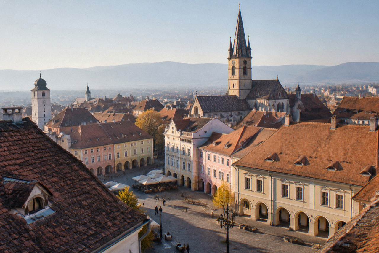
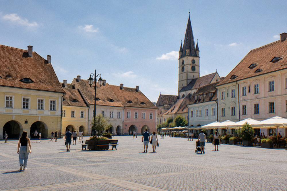
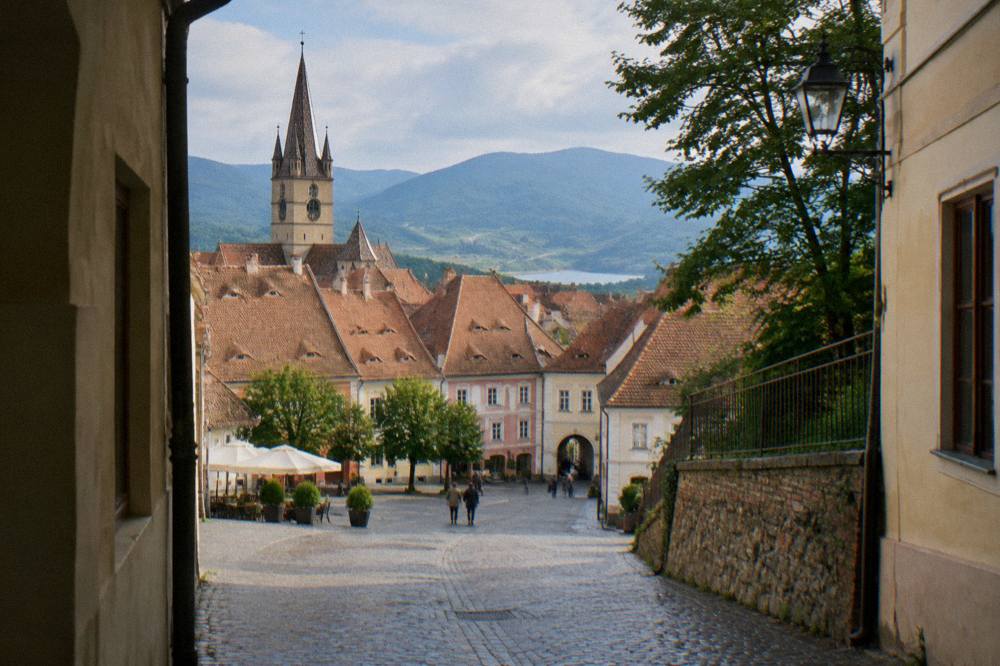
The Upper Town is the historical core the city is known for. Piața Mare, the Great Square, is its centre of gravity, with the Brukenthal National Museum's palace on its north-west side and the Council Tower marking the passage to Piața Mică. Piața Mică and then Piața Huet with the Evangelical Cathedral complete the plateau sequence, each a one or two minute walk from the last. The Lower Town, Orașul de Jos, begins literally below: its straight-line distance from Piața Mare is only about 0.4 kilometres, but the drop between the two levels is what gives Sibiu its stacked skyline.
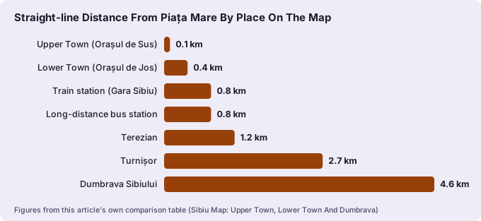
Beyond the old ring, the map fans out into named areas the site covers in detail: Terezian about 1.2 kilometres out, Turnișor about 2.7 kilometres, and Dumbrava Sibiului about 4.6 kilometres, all measured in a straight line from Piața Mare. The two transport gateways, the train station and the long-distance bus station, each sit about 0.8 kilometres from the square. For the full list of activities across these zones, start with things to do in Sibiu, and for sleeping arrangements read where to stay in Sibiu by area.
What Belongs To The Upper Town On A Sibiu City Map?
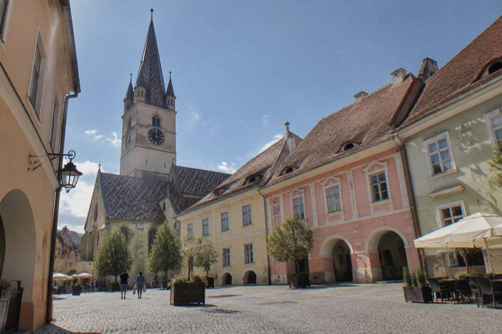
The Upper Town, Orașul de Sus, is the plateau district holding Piața Mare, Piața Mică and Piața Huet, along with the Brukenthal palace, the Council Tower, the Bridge of Lies, the Evangelical Cathedral and the surviving city walls and towers. It lies about 0.1 kilometres from Piața Mare at its nearest edge, which is to say the square is inside it. Every one of these sights is within a five minute walk of another.
Reading the plateau west to east: Piața Mare is the large open square used for events and the Christmas market; the Council Tower stands between it and Piața Mică, and the tower is closed to visitors, since 19 January 2026, for a restoration expected to run about two years. Piața Mică, the Little Square, is the ring of merchant houses, among them the Pharmacy History Museum at number 26 under the Black Bear sign, with an entry price of 16 RON. Across it, the Bridge of Lies, reportedly the first cast-iron bridge in Romania, carries the lane onward to Piața Huet, where the Evangelical Cathedral's tower is the open viewpoint in the city, at 10 RON for an adult ticket.
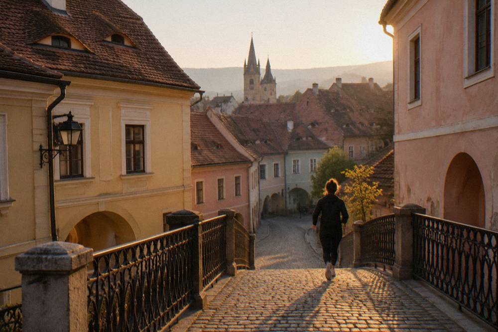
The Upper Town's rim is the medieval wall with its surviving towers, the Potters, the Arquebusiers and the Stairs towers among them, all free to walk along the outside. The Upper Town area guide maps each of these in sequence, and the Piața Mică attraction page covers the small square building by building. One planning note that matters on any current map: the main Brukenthal museums are closed Monday and Tuesday, the Contemporary Art Museum is closed at weekends, and the Hunting Museum is closed indefinitely, so the museum cluster only fully works Wednesday to Sunday.
For a route that strings the plateau landmarks together with a guide, the site's featured Upper Town landmarks city tour covers exactly this map zone.
What Belongs To The Lower Town And How Do The Two Levels Connect?
The Lower Town, Orașul de Jos, is the district below the plateau toward the Cibin river, about 0.4 kilometres from Piața Mare in a straight line, and its connection to the Upper Town is a set of stairs and passages cut into the slope, of which the Stairs Passage is the one on every map. Crossing between levels takes a few minutes on foot and no transport at all.
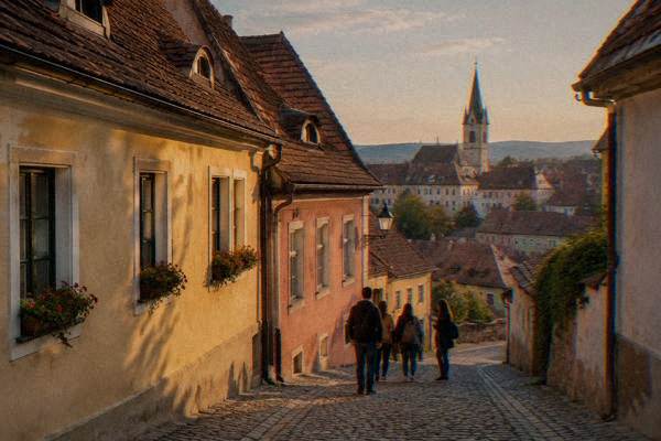
The Stairs Passage is the classic link, a covered stone stair running between the two levels near the Stairs Tower, and it is a free public route with no ticket and no hours. The Lower Town itself is the older, quieter layer: narrower lanes, smaller squares and the houses whose steep dormer roofs give Sibiu its famous "eyes" that seem to watch the street. The whole district is covered in the Lower Town area guide, and the passage itself has its own page on the Stairs Passage.
A practical reading of the map here: the Lower Town is where the city's ordinary life happens, so it rewards slow walking rather than tick-box sightseeing. There are no paid attractions of note down here; the value is the streetscape and the views back up at the plateau wall. Visitors with limited mobility should note that the connection between levels is by stairs, and no sourced step-free route was found for the passage, so plan the loop accordingly and confirm locally.
Where Is Dumbrava On The Sibiu Map And How Do You Get There?
Dumbrava is the forest park on Sibiu's southern edge, with the ASTRA open-air museum inside it on Calea Rășinari, and the museum's geocoded pin sits about 5.5 kilometres from Piața Mare, computed by road and straight line. That makes it a bus or taxi trip rather than a walk, unlike everything else on this map. The forest itself is a free public park with no ticket.
The ASTRA Museum of Traditional Folk Civilization spreads across the Dumbrava forest with its village houses, mills and farm buildings, and it is the one big Sibiu sight that is not in the old town. An adult ticket costs 50 RON, with pensioners at 20 RON and a group adult rate of 40 RON for 20 or more, per the museum's own price page. The autumn schedule ran to 26 October 2026 with last entry reported at about 16:00; the winter schedule had not been announced, so check the museum's own site for hours from November onward.
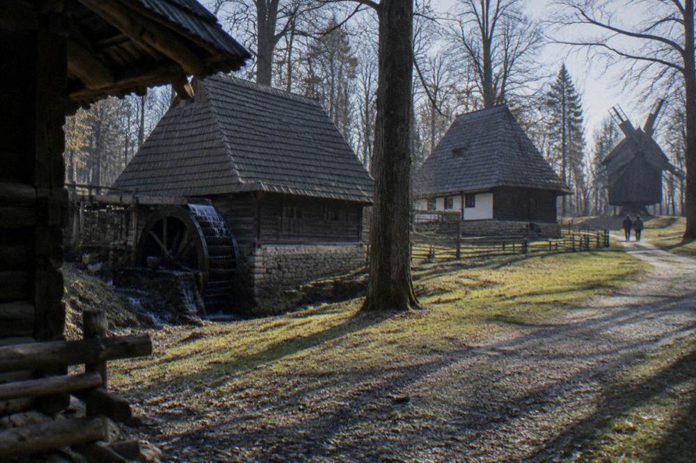
Getting there is simple on the map: follow Calea Rășinari south out of the centre. The Tursib city network covers the route, with a 60-minute ticket at 3.5 lei bought contactless on the bus. The Dumbrava area guide and the Dumbrava forest page cover the park itself, and the full museum is mapped on the ASTRA Museum page. The Sibiu Zoo sits in the same forest belt, but its entry price and hours were not confirmed, so check locally before planning a visit; the zoo page carries what is known.
How Far Are Sibiu's Areas And Gateways From Piața Mare?
Every named area of Sibiu sits within about 5 kilometres of Piața Mare: the Upper Town effectively at zero, the Lower Town at 0.4 km, Terezian at 1.2 km, Turnișor at 2.7 km, Dumbrava Sibiului at 4.6 km, and both the train station and the bus station at 0.8 km each. These are computed straight-line distances, and they explain why no visitor needs a car inside the city.
| Place on the map | Straight-line distance from Piața Mare |
|---|---|
| Upper Town (Orașul de Sus) | 0.1 km |
| Lower Town (Orașul de Jos) | 0.4 km |
| Train station (Gara Sibiu) | 0.8 km |
| Long-distance bus station | 0.8 km |
| Terezian | 1.2 km |
| Turnișor | 2.7 km |
| Dumbrava Sibiului | 4.6 km |
| ASTRA Museum, Dumbrava forest | about 5.5 km |
| Sibiu International Airport | about 5 to 6 km |
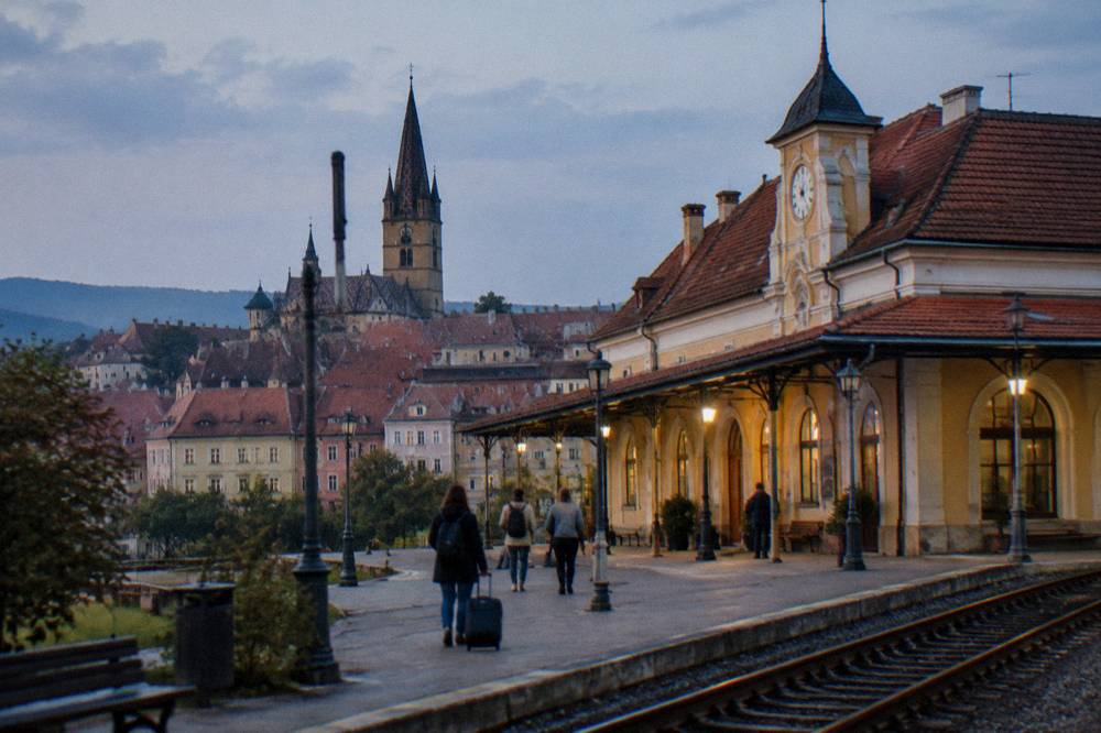
The airport row deserves its own sentence: the airport's own site quotes 3 kilometres, but road routing from Piața Mare to the terminal computes at about 6 kilometres, so treat 5 to 6 kilometres as the working figure. Tursib bus line 11 serves a dedicated stop in front of arrivals, with lines 112, 116, 117 and 118 also calling there, and the 60-minute ticket is 3.5 lei. The arrival sequence is mapped in full in how to get to Sibiu, with dedicated pages for Sibiu Airport and the train station.
Which Sights Cluster Together For A Walking Route?
The old-town sights fall into two tight clusters: the plateau cluster of Piața Mare, the Council Tower, Piața Mică, the Bridge of Lies and the Evangelical Cathedral, all inside about 300 metres of each other, and the wall cluster along the southern rim, the Stairs towers, the Stairs Passage and the Lower Town below. A visitor can walk both clusters in one loop of well under an hour of moving time.
| Sight | Map position | Entry |
|---|---|---|
| Piața Mare | Plateau centre | Free public square |
| Council Tower | Between Piața Mare and Piața Mică | Closed for restoration |
| Pharmacy History Museum | Piața Mică 26 | 16 RON adult |
| Bridge of Lies | East end of Piața Mică | Free public bridge |
| Evangelical Cathedral and tower | Piața Huet | Tower 10 RON adult |
| City walls and towers | Southern rim of the plateau | Free public access |
| Stairs Passage | Links plateau to Lower Town | Free public passage |
| ASTRA Museum | Dumbrava forest, about 5.5 km | 50 RON adult |
Two map corrections save wasted footsteps. First, the Council Tower cannot be climbed: it has been closed to visitors since 19 January 2026 for a restoration expected to last about two years, and the open viewpoint is the Evangelical Cathedral tower across Piața Huet. Second, the Brukenthal sights are not one building but several locations with separate tickets, so if the museum is the day's plan, the Brukenthal guide maps which branch sits where. For a wider sense of the year's best walking conditions, the Sibiu weather page and the best time to visit Sibiu carry the monthly picture, including snow from November to March in the ERA5 reanalysis, 1991-2020.
Which Parts Of The Map Cost Nothing To Walk?
The majority of Sibiu's mapped landmarks are free public spaces with no ticket and no opening hours: Piața Mare, Piața Mică, Piața Huet, the Bridge of Lies, the Stairs Passage, the city walls and towers, the Lower Town lanes and the whole of the Dumbrava forest. Only a handful of mapped points charge entry, and they are all museums or the cathedral tower.
| Free public space | Where on the map |
|---|---|
| Piața Mare | Plateau, city's main square |
| Piața Mică and Piața Huet | Plateau, east of Piața Mare |
| Bridge of Lies | Links Piața Mică to Piața Huet lane |
| City walls, Potters, Arquebusiers, Stairs towers | Southern and eastern rim of the plateau |
| Stairs Passage | The link down to the Lower Town |
| Lower Town streets and "eyes" rooftops | Below the plateau, toward the Cibin |
| Dumbrava forest | Southern edge, around the ASTRA Museum |
The free list is what makes Sibiu work as a walking city: a loop of the squares, the bridge, the walls and the passage costs nothing and needs no timings. The free things to do guide expands this list with routes. When the paid sights are added, budgets stay modest: the cathedral tower at 10 RON, the Pharmacy History Museum at 16 RON, the Brukenthal palace at 50 RON and the ASTRA Museum at 50 RON together cost less than many single Western European attractions, and the full picture is on what Sibiu costs.
Where Do Day Trips Leave From On The Sibiu Map?
Every Sibiu day trip starts from one of two mapped points: the old town itself for road tours heading south and west, or the ring roads around it, with the Transfăgărășan about 69 minutes and 63 kilometres from Piața Mare, Păltiniș about 40 minutes and 32 kilometres, and the Saxon villages of the Mărginimea 18 to 36 minutes out. These are computed free-flow road times, not timetables.
The map logic is straightforward: Sibiu sits at the junction of the old national roads, so the mountains are south, the Saxon villages are south-west and the bigger citadels are north-east toward Brașov and Sighișoara. The Transfăgărășan guide covers the high road, noting the 2026 season opened on 12 June with daily hours of 07:00 to 21:00 on the high stretch and the rule that it can be closed on any day from 20 October, so check the live road status before setting out. Bâlea Lake sits at 2,034 metres at the road's top, about 88 minutes and 76 kilometres from the square.
The Saxon fortified-church country to the south-west is closer than the mountains: Rășinari about 18 minutes and 13 kilometres, Cisnădie about 14 minutes and 10 kilometres, Sibiel about 36 minutes and 25 kilometres, all computed over standard routing. A guided day covering that village belt is one of the site's featured picks, and the Saxon villages and fortified churches day tour runs it from the city. For the classic pairing of road and lake with a stop in Avrig, the Sibiu and Transfăgărășan itinerary maps the full loop, and car rental in Sibiu covers driving yourself.
Which Map Zone Suits Which Kind Of Visit?
The plateau suits a first visit built around squares, museums and the cathedral tower; the Lower Town suits a second, slower visit of lanes and rooftops; Dumbrava suits a half day given the 5.5 kilometre distance; and the day-trip belt suits anyone staying three nights or more. In one day, the plateau plus one Brukenthal branch is realistic; in three, the whole map including ASTRA and a village trip fits comfortably.
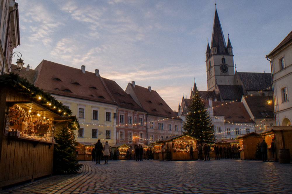
Season changes the reading too. In winter the Christmas market fills Piața Mare from 13 November 2026 to 3 January 2027, which pulls the whole visit onto the plateau; the Sibiu Christmas market guide maps the stalls, the 600 square metre rink and the square's layout. In summer the squares host the theatre festival in June and open-air events later in the season, and the summer guide and the December guide carry the seasonal versions of this same map.
Food sits on the map mostly in and around the two town levels, and the what to eat in Sibiu guide names the dishes worth finding, from ciorbă and mici to papanași. Evening plans cluster on the plateau and Piața Mică; a wine tasting in the centre is one of the site's picks, and the Romanian wine tasting in Sibiu page carries the details.
Common Questions About The Sibiu Map
Is Sibiu walkable without a map?
The old core is about one kilometre across and built on two levels, so the three plateau squares, the walls and the Stairs Passage down to the Lower Town can all be covered on foot in a single loop. Only Dumbrava and the airport, each about 5 to 6 kilometres out, need a bus or taxi.
How far is the ASTRA Museum from the centre of Sibiu?
The museum's pin in the Dumbrava forest on Calea Rășinari computes at about 5.5 kilometres from Piața Mare. A Tursib bus covers the route with a 3.5 lei 60-minute ticket bought contactless on board.
Can you climb the Council Tower on a Sibiu visit?
No. The Council Tower has been closed to visitors since 19 January 2026 for a restoration expected to run about two years. The open viewpoint in the city is the Evangelical Cathedral tower in Piața Huet, 10 RON for an adult.
Which Sibiu sights are free?
Piața Mare, Piața Mică, Piața Huet, the Bridge of Lies, the Stairs Passage, the city walls and towers, the Lower Town streets and the Dumbrava forest are all free public spaces with no ticket and no opening hours.
How do you get between the Upper Town and the Lower Town?
The two levels connect by stairs and passages cut into the slope, the best known being the covered Stairs Passage near the Stairs Tower. The crossing takes only a few minutes on foot; no sourced step-free route was found, so confirm locally if that matters to your plans.
Where do day trips from Sibiu start?
Road day trips leave from the old town or the ring roads: Păltiniș is about 40 minutes and 32 kilometres away, the Transfăgărășan about 69 minutes and 63 kilometres, and the Mărginimea villages 18 to 36 minutes. Train day trips to Sighișoara or Brașov leave from Gara Sibiu, 0.8 kilometres from Piața Mare.
Read the map once more before arrival and Sibiu stops being a puzzle: three squares on a plateau, a stairway down to the older town, a forest on the southern edge, and mountains an hour beyond it.